The field crew sets up a portable rainfall simulator on a sloped lot near the Elizabeth River, where the sandy loam and clay layers typical of Chesapeake's coastal plain are exposed. Water is applied at a controlled intensity to measure runoff volume, sediment concentration, and infiltration rate. These tests quantify how much surface soil can be lost during a design storm event. Data from the simulator is combined with on-site permeability tests using a double-ring infiltrometer to calibrate the erosion model. Before running the simulation, we always verify the soil classification with a granulometry test to understand the particle size distribution driving detachment behavior. The entire setup follows ASTM D422 for sieve analysis and ASTM D698 for moisture-density relationships, ensuring results are repeatable and defensible for regulatory review.
Runoff plots and rainfall simulation calibrated against local storm data give Chesapeake developers a defensible erosion analysis that meets state sediment control requirements.
Approach and scope
Site-specific factors
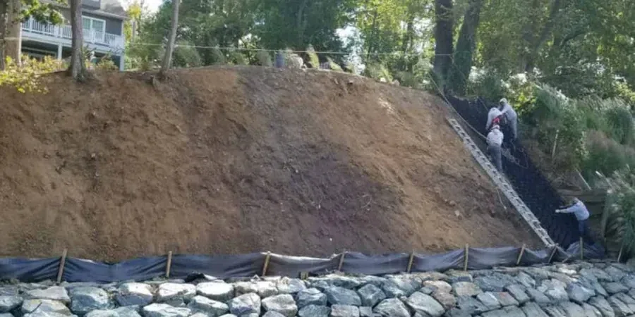
Chesapeake sits on the Atlantic Coastal Plain with elevations ranging from sea level to barely 30 feet above it. Shallow groundwater and permeable sandy soils make erosion a real concern after heavy rains. Hurricane season can drop 8 inches in 24 hours, saturating the ground and turning bare slopes into muddy gullies. Failing to assess erosion potential before clearing land can lead to sediment runoff into protected wetlands and creeks like the Southern Branch of the Elizabeth River, triggering fines from the Virginia Department of Environmental Quality. Even minor slope failures on construction sites can delay projects for weeks while remediation and replanting take place. That is why we run quantitative erosion analyses that account for local rainfall intensity, soil texture, and drainage patterns.
Relevant standards
ASTM D422 — Particle-size analysis, ASTM D698 — Standard Proctor compaction, RUSLE2 — Revised Universal Soil Loss Equation, Virginia Erosion and Sediment Control Handbook (VESCH)
Related technical services
Rainfall Simulation & Runoff Plots
Portable rainfall simulators and field plots measure direct runoff and sediment yield under controlled precipitation. Tests follow ASTM standards and output data for RUSLE2 modeling. Ideal for pre-construction baseline or post-construction compliance monitoring.
Erosion Control Plan Review & Modeling
We review existing erosion and sediment control plans, run quantitative models (RUSLE2, SEDCAD), and suggest improvements. Services include check dam sizing, silt fence layout, and phasing schedules to minimize bare soil exposure during construction.
Typical parameters
FAQ
What does a soil erosion analysis include for a Chesapeake construction site?
It includes field work — rainfall simulation, runoff plot installation, infiltration testing — plus laboratory analysis of soil texture and compaction. We then run RUSLE2 or SEDCAD models to predict erosion rates under local rainfall patterns. The final report provides sediment yield estimates, peak discharge, and recommendations for erosion control measures.
How much does a soil erosion analysis cost in Chesapeake?
The typical range for a residential or small commercial site is between US$910 and US$2.770, depending on the number of plots, storm events monitored, and lab testing required. Larger developments or sites requiring multiple monitoring rounds fall at the higher end. Contact us with your lot size and project phase for a specific quote.
Do I need an erosion analysis before clearing land in Chesapeake?
Yes, if your project disturbs one acre or more, a Virginia Erosion and Sediment Control Plan is legally required. Even for smaller sites, a quantitative erosion analysis helps avoid sediment runoff into nearby waterways like the Elizabeth River or Indian Creek, and can prevent costly stop-work orders from local authorities.
What is the difference between RUSLE2 and SEDCAD for erosion modeling?
RUSLE2 estimates long-term average annual soil loss from sheet and rill erosion based on rainfall, soil, slope, and management factors. SEDCAD is a storm-event-based model that simulates sediment transport and deposition in channels and basins. For Chesapeake projects, we often use RUSLE2 for planning and SEDCAD for designing sediment basins and check dams.